Science
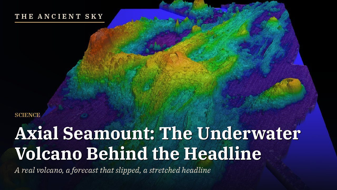
Axial Seamount: The Underwater Volcano Behind the Headline
By Darrell Wallen
Would you prefer to listen?
§ 1The hook
Picture a mountain more than a thousand meters tall, sitting on the floor of the Pacific Ocean about three hundred miles off the coast of Oregon. You cannot see it. You cannot hear it. Nobody lives near it. And yet it is, right now, one of the most closely watched volcanoes on Earth, with a fiber-optic cable running to it from the Oregon shore, carrying every little shiver of its rock to computers in Seattle in real time.
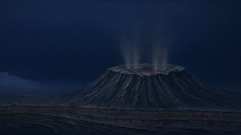
Now picture the headline. "Mile-wide underwater volcano ready to erupt off the West Coast." Scientists say ten thousand earthquakes in a single day. Within a few months. If you read only that, you would be forgiven for wondering whether you ought to be watching the Pacific from your porch.
I want to slow that story down today. The volcano is real, and the science is some of the most interesting in earth science. But I went and found the original CNN story, checked it against the researchers who run the instruments, and checked how it lines up with what has happened since. What I found is a real volcano, a real forecast, a forecast that did not come true on schedule, and a lot of details that got stretched along the way.
By the end of this episode, I will tell you plainly what is known, what is forecast, and what it does and does not mean for people living on the West Coast. Let's start with the headline itself.
§ 2What the CNN story actually said
The story in question is from CNN, written by Kameryn Griesser, and it was published on May 8, 2025, at eight in the morning Eastern time. That matters, because today is October 26, 2026. The article is about seventeen months old. I found no newer CNN story making the same claims. The most recent CNN piece in this area, from June 18, 2026, is about the National Science Foundation reversing a plan to dismantle ocean monitoring equipment, not about an eruption. So if a version of this story reached you this week, it is very likely the May 2025 article, or something quoting it, making the rounds again.
Here is what that article says. It describes a volcano called Axial Seamount, sitting, in CNN's words, nearly one mile, or one point four kilometers, underwater. The article quotes William Wilcock, an oceanographer at the University of Washington, saying that an eruption could come, and I am quoting him directly here, "later this year or early 2026, but it could be tomorrow, because it's completely unpredictable." It says that the last eruption, in 2015, produced roughly ten thousand earthquakes in a single day, and that "the same can be expected for the next one." It says lava from an eruption could trail about twenty-five miles. It quotes another University of Washington scientist, Deborah Kelley, describing an eruption as "not a very explosive event," with no ash clouds. And it points out that the three recent eruptions, in 1998, 2011 and 2015, all happened between January and April.
Notice what is in that article, and what is not. It says the volcano could erupt soon. It does not say the volcano will explode; its own scientists say the opposite. It gives a window of later in 2025 or early 2026, not a few months from now. And the "mile" in the body is a depth, not a width. The "mile-wide" shows up in the headline, a good first lesson in how a story shifts.
There is one more thing about the earthquake number. The University of Washington and the Ocean Observatories Initiative describe the 2015 eruption as about eight thousand earthquakes in twenty-four hours. CNN rounded that up to ten thousand. It is a different number, and it describes the past, not a prediction.
§ 3What Axial Seamount is, and how big
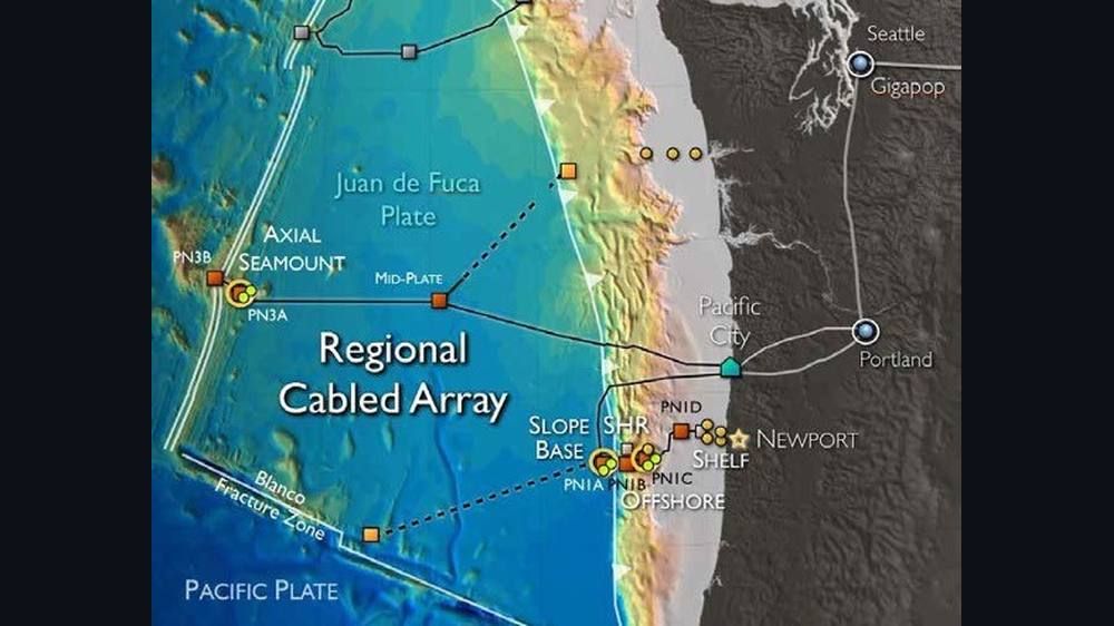
So what is this thing? Axial Seamount is a submarine volcano, a basaltic one, meaning it erupts runny lava rather than thick, explosive magma. It sits on the Juan de Fuca Ridge, which is a long crack in the Pacific seafloor where two pieces of the Earth's crust are slowly pulling apart. It is about three hundred miles, roughly five hundred kilometers, west of the Oregon coast. NOAA's research ship Surveyor first found it in 1981, and scientists have been studying it ever since. NOAA set up an observatory there in 1996.

Now, size. The top of the volcano is about fourteen hundred meters below the sea surface, a little under a mile of water. The University of Washington describes the whole mountain as rising about thirty-six hundred feet above the surrounding seafloor. At the summit is a big, unusual, almost rectangular caldera, roughly three kilometers by eight kilometers. That works out to about two miles by five miles. A caldera is a depression left when the roof of a magma chamber collapses, and this one has collapsed during multiple eruptions. Two long rift zones run about fifty kilometers off to the northeast and southwest. And Wilcock told the University of Washington that this combination, a real hotspot sitting directly on a mid-ocean ridge, is "not very common."
So where does "mile-wide" come from? I could not find a scientific source that describes Axial as one mile across. The mile in most reporting is the depth. The headline writer seems to have swapped depth for width. I could not trace the figure to any source, so I will not guess where it came from. Whatever its origin, the correct picture is this: a mountain that is a good deal wider than a mile, sitting under about a mile of water.
§ 4Three eruptions: 1998, 2011 and 2015
Axial's reputation rests on the fact that it has erupted three times in the age of modern instruments. The first was in January 1998. Seismic instruments picked up the eruption, and scientists were able to follow what happened on the seafloor. NOAA's Pacific Marine Environmental Laboratory calls it the first time a submarine eruption was caught in the act, because a seafloor pressure recorder was overrun by the lava, survived, and recorded the whole thing. The first estimate of the erupted volume, published in 1999, was between eighteen and seventy-six million cubic meters, and later high-resolution mapping put the volume of the lava flows at about thirty-one million cubic meters.
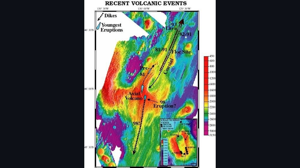

The second was in April 2011. A 2012 paper in Nature Geoscience by William Chadwick of Oregon State University, Scott Nooner, Butterfield and Lilley described the seafloor swelling that preceded it.
The third was April 24, 2015, and this is the one that changed the field. By then the cable was in place, so the University of Washington and the Ocean Observatories Initiative team were able to watch it live. Wilcock and colleagues reported in the journal Science that the instruments recorded about eight thousand earthquakes in twenty-four hours, and that the floor of the caldera sank about two point four meters as magma drained out from beneath it. Chadwick and his colleagues later measured about one hundred forty-eight million cubic meters of fresh lava, spilling from at least eleven flows along a stretch of fissures about nineteen kilometers long.
Wilcock has described the sequence in plain terms. First there is a burst of earthquakes as magma moves upward, lasting about an hour. Then the magma reaches the surface. Lava spreads across the caldera, and fissures open to the north and south. The shaking dies down over a few days, but the eruption itself keeps going slowly for about a month. And when hot lava traps seawater, it flashes to steam, forms a bubble, and then collapses with a loud implosion that the hydrophones pick up.
One more important point from that period. Nooner and Chadwick showed that the seafloor had been rising steadily before each eruption, like a balloon being slowly filled, and that the 2015 eruption could be forecast months ahead. The forecasting-experiment paper says the 2015 eruption was anticipated about seven months in advance, within a one-year window. That success is the reason this volcano has become a scientific test case, and also the reason the next forecast drew so much attention.
All three eruptions came between January and April, as CNN noted. The scientists I read offer no accepted explanation, and with only three events it may be coincidence.
§ 5How scientists watch a volcano on the seafloor
Now, the part I find most impressive. How do you watch a volcano that is a mile under the ocean and three hundred miles from shore?
You run a cable. The Ocean Observatories Initiative Regional Cabled Array uses roughly nine hundred kilometers of modified fiber-optic telecommunications cable. It starts at a shore station in Pacific City, Oregon, and runs out across the Juan de Fuca plate to seven primary nodes on the seafloor, one of which sits on Axial. The cable carries power down, ten thousand volts of direct current and up to eight kilowatts, and carries data back up at ten gigabits per second. More than a hundred and fifty instruments are connected. The University of Washington operates the array, and Deborah Kelley directs it. The seafloor system has been running since 2014.
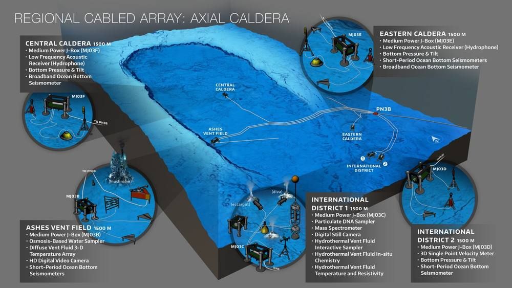

At Axial, the key instruments are seismometers and bottom pressure recorders. The seismometers detect earthquakes, most of them tiny. In the catalog the scientists maintain, magnitudes run from about negative one point seven to three point four, with an average of about zero point two. Those are too small to feel on land.
The bottom pressure recorders are the clever part. A pressure sensor on the seafloor feels the weight of the water above it. If the seafloor rises, there is less water overhead and the pressure drops; if it sinks, the pressure rises. Four of these sit in and around the caldera, recording once per second. After correcting for tides and subtracting a reference instrument outside the caldera, scientists get the noise down to about one centimeter, with sensor drift held under half a centimeter a year. That is how they can say the seafloor has risen by so many centimeters over so many years. That is seafloor geodesy.
Jackie Caplan-Auerbach, a seismologist at Western Washington University, put it this way: seafloor eruptions happen all the time, but we have no way of knowing it, and Axial is the only undersea volcano for which we have live data. Part of why Axial gets all the headlines is that it is the one we can see.
There is a 2026 wrinkle, because the whole system depends on public funding. On May 21, 2026, the National Science Foundation announced a plan to remove underwater equipment from four Ocean Observatories Initiative arrays, though the cabled array at Axial was to stay. On June 18, 2026, CNN reported that the NSF had reversed course after a bipartisan backlash, with one array off Oregon and Washington already pulled up. The Axial cable kept running throughout. Somebody has to keep paying for the watching.
§ 6The forecast, and what happened to it
Now we get to the part that matters most: the forecast itself. It is a more interesting story than the headline.
In December 2024, researchers presented new results at the annual meeting of the American Geophysical Union. The message was that Axial was well on its way to an eruption, possibly before the end of 2025. The seafloor had risen back toward the level it had reached before the 2015 eruption, and the earthquakes were picking up. Gizmodo ran it on January 3, 2025, under the headline "Underwater Volcano Off Oregon Will Erupt This Year, Scientists Predict." In spring 2025 the instruments logged more than a thousand small earthquakes a day at times, and ABC News reported at least one day with more than two thousand. Then, on May 8, 2025, NBC and CNN pushed the story to a very wide audience.
And then 2025 ended, and Axial did not erupt.
I want to be fair here. The scientists said "possibly" and "could," and Wilcock said it was "completely unpredictable." But the 2025 window passed without an eruption. Science News reported on December 22, 2025, that the researchers had updated their outlook, and that the thresholds they were watching could be reached before the end of 2026. Through 2026, the updates from William Chadwick and Scott Nooner, on the Oregon State web page and blog, say the seafloor has re-inflated, but the rate of swelling has slowed and the earthquake rate has stayed relatively low. In plain language, they say it does not look imminent. The latest post on their blog, dated October 25, 2026, which is yesterday, is about Kilauea in Hawaii, and reports no eruption at Axial. The University of Washington's live earthquake page, which I checked on the evening of October 26, shows the data stream running normally.
So when somebody says "within a few months," I cannot find a scientist saying that today. What I can find is a volcano that is primed, that has not gone, and whose timing is genuinely unknown.
Why is the timing so hard? The 2015 forecast worked in part because the seafloor was rising at a fairly steady rate. Afterward the rate varied, and the forecasting-experiment paper says later attempts with the same pattern-matching technique have not produced reliable forecasts. The one success was a promising pattern that has not repeated cleanly.
This is why the volcano has become a testing ground. A group of researchers, Qinghua Lei and Didier Sornette with William Chadwick, Scott Nooner, Maochuan Zhang and William Wilcock, launched what they call the Axial Seamount Eruption Forecasting Experiment. Starting on November 8, 2025, they have been issuing sealed forecasts, roughly monthly. Each is locked with a cryptographic fingerprint and dated, but the contents stay secret until after the next eruption. The tenth release came on September 8, 2026. The idea is that once the volcano goes, anybody can check whether the forecasts were right, wrong, or lucky. That paper also states that a prevailing view among volcanologists is that long-term eruption forecasts are generally not feasible. So this is an experiment in whether that view is true.
I find that admirable. The headline says a volcano is ready to blow. The scientists say we have a rare chance to learn whether one can be predicted, and they will publish every miss.
A quick word on the people. William Wilcock is a University of Washington oceanography professor and seismologist. Maya Tolstoy is a marine geophysicist and the Maggie Walker Dean of the University of Washington College of the Environment. Deborah Kelley is a University of Washington oceanography professor and director of the Regional Cabled Array. William Chadwick is at Oregon State University's Hatfield Marine Science Center and does the seafloor geodesy. Scott Nooner is at the University of North Carolina Wilmington. Maochuan Zhang at the University of Washington helps run the earthquake catalog. One name I was asked about, Mika Thomas, I could not connect to Axial at all, so I am leaving it out.
§ 7Does it threaten the West Coast?
This is the question everybody really wants answered, so let me give you the answer directly, and then show you why.
The scientists who study Axial say no. The University of Washington College of the Environment wrote in April 2025 that Axial is, and I quote, "much too deep and far from shore for people on land to even notice when it erupts." It added that an eruption "has nothing to do with seismic activity on land," so people in the Pacific Northwest don't need to worry about it setting off a major earthquake or tsunami.
Jackie Caplan-Auerbach of Western Washington University was even more direct in May 2025. She said residents of the Pacific Northwest "should expect to see nothing when Axial erupts." And then she listed it: the eruption "will not reach the surface, it will not generate a tsunami and it will not cause large earthquakes." It will, she said, all be very subtle and remain deep in the ocean.
Why? Three reasons. The first is depth. Lava erupting under roughly fourteen hundred meters of water is cooled and pressed down by the ocean. It cannot throw an ash cloud into the sky the way a volcano on land does. Kelley's phrase, "not a very explosive event," is a good summary.
The second is the type of eruption. Axial erupts runny basalt that oozes, rather than thick magma that explodes. The big tsunamis people associate with underwater volcanoes come from huge explosions or flank collapses, and nothing in the 1998, 2011 and 2015 records looks like that.
The third is geology. This is the one that matters most for the West Coast. Axial sits on the Juan de Fuca Ridge, which is a spreading boundary, where plates move apart. The big hazard on the Pacific Northwest coast is something else entirely, the Cascadia subduction zone, which runs close to shore, from northern California to British Columbia. There the Juan de Fuca plate slides under North America at about four centimeters a year, according to the U.S. Geological Survey. The last great Cascadia earthquake was on January 26, 1700, estimated at somewhere between magnitude eight point seven and nine point two. The USGS estimates about a ten percent chance of a full-length magnitude nine Cascadia earthquake in the next fifty years on one model, or fifteen percent on another.
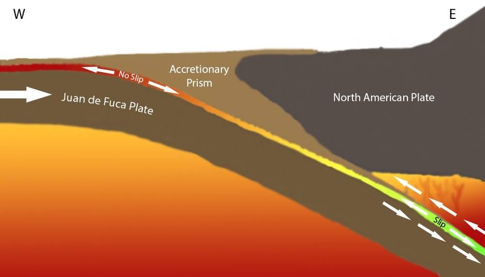

So here is the honest point. The Cascadia risk is real, and worth every bit of preparation people give it. But it is a separate fault, doing a separate job, from the volcano three hundred miles out. I found no peer-reviewed paper claiming that an Axial eruption triggers a Cascadia earthquake, and the University of Washington and Western Washington say there is no connection. If you see a post saying Axial could set off "the Big One," treat it as unsupported.
§ 8Life at the vents
Here is something the headline never mentions, and it is the part that scientists get most excited about. A volcano on a mid-ocean ridge is not only a hazard. It is an engine for life.
Seawater seeps down through cracks in the seafloor, gets heated by the magma below, and shoots back out as mineral-rich jets that can pass seven hundred degrees Fahrenheit. In the dark, there is no sunlight to power anything, so microbes use dissolved volcanic gases for energy instead. Those microbes feed tubeworms, spider crabs, clams, fish and even octopuses. Deborah Kelley told the University of Washington that most of the seafloor is plain, but when you reach a vent field, "the volcano is an oasis of life." Axial has three main vent fields, named CASM, ASHES and the International District, and NOAA's New Millennium Observatory has studied how the 1998 eruption created new vents and partly buried old communities.
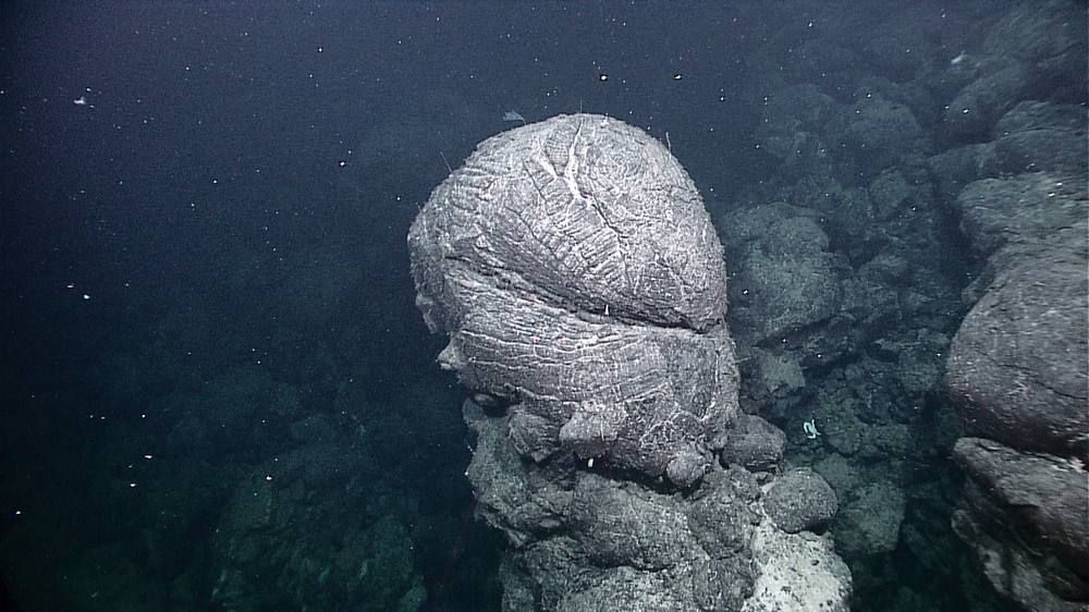

Kelley also describes "snowblowers," plumes of warm fluid carrying billions of microbes that appear after an eruption, which scientists have seen only a handful of times. Maya Tolstoy notes that over two thirds of the Earth's surface was formed by eruptions at mid-ocean ridges. Yet no one had directly watched one erupt along this chain until April 29, 2025, when scientists in the submersible Alvin saw it happen on the East Pacific Rise. A vent field full of tubeworms one day was barren and buried under fresh basalt the next, according to Woods Hole. That is why the scientists are eager rather than afraid. They want to see what happens.
§ 9Other underwater volcanoes in the news
Axial is not the only one that gets headlines, so let me put it in company.
Off the big island of Hawaii sits Kamaʻehuakanaloa, which used to be called Lōʻihi. Its summit is about nine hundred seventy-five meters below the surface. In the summer of 1996 the U.S. Geological Survey recorded the largest earthquake swarm ever documented at a Hawaiian volcano: more than four thousand quakes between July 16 and August 9, including a magnitude five, and it carved out a pit crater about six hundred meters wide. It is the youngest volcano in the Hawaiian chain, and it is still under water.
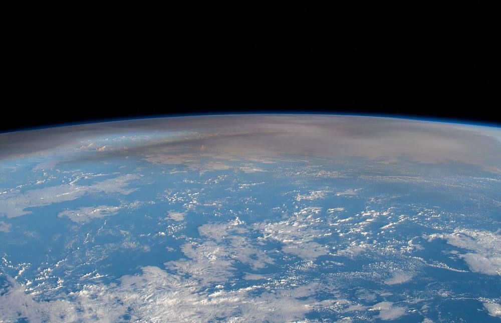
Hunga Tonga is the one people point to as the scary case. On January 15, 2022, it exploded, sending a plume about fifty-eight kilometers up into the mesosphere, according to NASA, and producing tsunami waves that crossed the Pacific. But it was shallow and explosive, and those two features made it dangerous. Axial has neither.

Kavachi, in the Solomon Islands, has a summit only about twenty meters below the surface and has been in an eruptive phase since 2020. In 2015, researchers photographed sharks inside its crater, which is how it earned the nickname "sharkcano." And Marsili, in the Tyrrhenian Sea off Italy, is described by the Italian volcano institute as the largest and highest active volcano in Europe, about seventy kilometers long. It last erupted two or three thousand years ago. The institute says the surface risk from an eruption is extremely low because of the depth. The worry in modeling studies is a flank collapse, not an eruption. Notice the pattern: the same words, "largest," "active," show up in headlines, and the details about depth and eruption style get left out.
§ 10How a headline gets stretched
Let me pull together how the Axial story changed shape, because it is a case study. William Chadwick's own blog, which he writes with Scott Nooner, sorts the coverage into good, bad and ugly, and it notes that interest came in waves. The first wave followed the December 2024 forecast. The second followed NBC's report on May 8, 2025, the same day as CNN's.
Along the way, a few things shifted. "Mile-deep," which is accurate, became "mile-wide," which is not. Some outlets, such as ABC News and People, kept "mile-deep." About eight thousand earthquakes became ten thousand. A window of "later this year or early 2026" became "within a few months," which is true to neither the original nor the present. "Could erupt" became "ready to blow its top." "Three hundred miles out at sea" became "off the West Coast." And a forecast that was updated, and that missed its first window, kept circulating as if it were fresh.
One more caution. I found a self-published note on a public research-sharing site, dated October 23, 2026, claiming about a thousand earthquake detections a day in early October. It is not peer reviewed, and Chadwick's update two days later does not mention it. I did not use it. Wait for the Oregon State or University of Washington pages before trusting a figure like that.
Which brings me to the fair take. The coverage was not baseless. The volcano is real, and the scientists did say it could erupt. But the headline compressed their caution into certainty and swapped a few details. A healthy way to read these stories is to find the quote from a scientist and ask what it actually claims. Here, the scientist claimed that nobody knows when.
§ 11What this all means
So let me finish with where things stand as of October 26, 2026.
What is known. Axial Seamount is a large, deep, basaltic volcano about three hundred miles off Oregon. It erupted in January 1998, April 2011 and April 2015. The 2015 eruption brought about eight thousand earthquakes in a day and about a hundred and forty-eight million cubic meters of lava. It is monitored in real time by a cabled observatory run by the University of Washington, and as of Chadwick and Nooner's update on October 25, 2026, it has not erupted since.
What is forecast. In late 2024, scientists said an eruption was possible before the end of 2025. That did not happen. The updated outlook, reported in December 2025, is that the thresholds could be reached before the end of 2026. The seafloor has re-inflated, but through 2026 the swelling has slowed and the earthquake rate has stayed relatively low, and the scientists say an eruption is not imminent. No one can say when. An open experiment is testing whether forecasting is even possible, with sealed forecasts to be revealed after the next eruption.
What it means for the West Coast. For people on land, almost nothing. The scientists say there will be no tsunami, no ash, no large earthquakes, and no trigger for the Cascadia fault, which is a separate and genuine hazard worth preparing for on its own terms. For the rest of us, it means something quieter. It means a rare chance to watch a volcano erupt in real time on the seafloor, to learn how life copes with it, and to find out whether eruptions can be forecast at all.
And what it does not mean. It does not mean a mile-wide volcano is about to blow its top on the coast. It does not mean ten thousand earthquakes are forecast in the next few months. And it does not mean the volcano is a threat to your town. If it erupts next week, you will probably read about it, not feel it. Thanks for listening. Stay curious, and check the sources.
Watch & Listen
Hear this entry read aloud. Coming soon — the channels are not live yet.
Sources
Articles and papers
- CNN, Kameryn Griesser, May 8, 2025
- CNN, Trump administration reverses plan to ditch ocean monitoring system, June 18, 2026
- NBC News, May 8, 2025
- ABC News, mile-deep underwater volcano report
- People, Axial Seamount report
- Gizmodo, January 3, 2025
- Science News, December 22, 2025
- Science News, December 27, 2024
- OPB, June 25, 2024
- Forbes, May 9, 2025
- Fox News
- Western Washington University, Q&A with Jackie Caplan-Auerbach, May 16, 2025
- Lei, Sornette, Chadwick, Nooner, Zhang and Wilcock, "Axial Seamount Eruption Forecasting Experiment" (arXiv preprint, 2025)
- Wilcock et al., Science 354:1395 (2016)
- Nooner and Chadwick, Science 354:1399 (2016)
- Chadwick et al., Geophysical Research Letters (2016)
- Chadwick et al., Nature Geoscience (2012)
- Chadwick et al., Geochemistry, Geophysics, Geosystems (2022)
- Hunga Tonga atmospheric waves, Science
- Tonga tsunami, NHESS (2023)
- "Exploring the Sharkcano" (Kavachi), Oceanography
- Marsili flank-collapse tsunami modelling, Bulletin of Volcanology
- USGS Fact Sheet 2025-3050, Earthquake probabilities in the U.S. Pacific Northwest
- Embley, Chadwick, Clague and Stakes, "1998 eruption of Axial Volcano: Multibeam anomalies and sea-floor observations," Geophysical Research Letters (1999)
- Fox, Chadwick and Embley, "Direct observation of a submarine volcanic eruption from a sea-floor instrument caught in a lava flow," Nature 412:727 (2001)
- Chadwick et al., "The 1998 eruption of Axial Seamount: New insights on submarine lava flow emplacement from high-resolution mapping," Geochemistry, Geophysics, Geosystems (2013)
- Caress et al., "Repeat bathymetric surveys at 1-metre resolution of lava flows erupted at Axial Seamount in April 2011," Nature Geoscience (2012)
- Wilcock et al., "The recent volcanic history of Axial Seamount: Geophysical insights into past eruption dynamics with an eye toward enhanced observations of future eruptions," Oceanography 31(1):114 (2018)
- Kelley et al., "Establishing a new era of submarine volcanic observatories: Cabling Axial Seamount and the Endeavour Segment of the Juan de Fuca Ridge," Marine Geology 352 (2014)
- Grokipedia, Juan de Fuca Ridge
- Grokipedia, Hydrothermal vent
- Grokipedia, Cascadia subduction zone
- Grokipedia, Kamaʻehuakanaloa Seamount
- Grokipedia, Hunga Tonga-Hunga Haʻapai
- Grokipedia, Kavachi
- Grokipedia has no page for Axial Seamount itself (checked October 26, 2026).
- Also see (aggregators; leads only, not used as support for any claim): Wikipedia, Axial Seamount: en.wikipedia.org/wiki/Axial_Seamount (Grokipedia has no matching page)
- Reviewed but not relied on (unreviewed self-published note)
Institutional pages
- Oregon State University, Axial blog by Chadwick and Nooner
- Oregon State University, "Has Axial Seamount Erupted Yet?"
- Oregon State University, eruption forecasts
- University of Washington, Axial earthquake catalog
- University of Washington College of the Environment, April 2025
- University of Washington, 2015 eruption
- University of Washington, Regional Cabled Array
- OOI Regional Cabled Array, Interactive Oceans
- Ocean Observatories Initiative, cabled Axial array
- Ocean Observatories Initiative, descoping announcement, May 21, 2026
- OOI Ocean Data Labs, Axial eruption
- NOAA PMEL, NeMO background
- NOAA PMEL, "The Rumbleometer story" (1998 eruption caught by a seafloor instrument)
- Ocean Observatories Initiative, ASHES Vent Field
- NOAA PMEL, NeMO Net
- USGS, Kamaʻehuakanaloa
- USGS Volcano Watch, 1996 Lōʻihi swarm
- NASA Earth Observatory, Tonga plume
- Smithsonian Global Volcanism Program, Kavachi
- INGV, Marsili
- Pacific Northwest Seismic Network, Cascadia megathrust
- Woods Hole Oceanographic Institution, Alvin witnesses a seafloor eruption
Videos (views checked October 26, 2026)
- NBC News, Axial Seamount report, 507,272 views
- Nick Zentner, "Axial Volcano Eruptions w/ Bill Chadwick," 19,544 views
- Hatfield Marine Science Center, Chadwick seminar, 571 views
- Woods Hole Oceanographic Institution, "Studying Submarine Volcanoes," 11,276 views
- Woods Hole Oceanographic Institution, "Underwater volcano explodes in the Pacific!," 37,837 views
- PBS NewsHour, "The challenges of wiring up an undersea volcano" (views not available)
- Alarm-style videos with higher view counts exist; none were linked.
Books
- Jerry Thompson, Cascadia's Fault: The Coming Earthquake and Tsunami That Could Devastate North America (Counterpoint, 2011).
- Brian Atwater et al., The Orphan Tsunami of 1700 (USGS Professional Paper 1707, 2005)
- Claire Nouvian, ed., The Deep: The Extraordinary Creatures of the Abyss (University of Chicago Press, 2007)